 York Illustrated
This set of four of cross-sections through the ramparts show how this section of the city's defences evolved over a period of more than thirteen centuries.
There are four pebble-faced cross-sections, each labelled with a carved stone sign.
Image 1
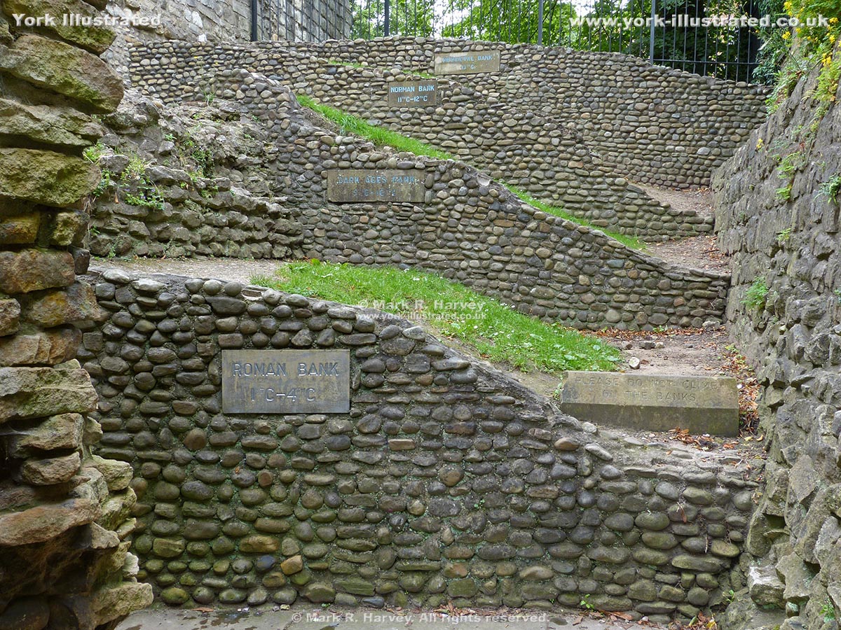
The carved-stone signs visible in Image 1 read as follows (from top to bottom):
- MEDIAEVAL BANK
13TH C - NORMAN BANK
11TH C - 12TH C - DARK AGES BANK
5TH C - 10TH C - ROMAN BANK
1ST C - 4TH C
These interpretive cross-sections were created following archaeological excavations in 1969-70 to investigate and record the structure of the walls and ramparts near tower 19. A more detailed cross-section diagram (of a nearby section of the ramparts) is available on the British History Online website - see the 'External Links' section below for details and link.
The interpretive cross-sections shown in Image 1 are located beside the city wall, in the grounds of - and to the rear of York City Library (now known as York Explore). The only public access to this area is from Museum Gardens via a small doorway through the city wall behind the fernery (close to the Multangular Tower).
External Links
A more detailed cross-section of the ramparts is available as part of the notes relating to Tower 19 in 'The Central Area', in An Inventory of the Historical Monuments in City of York, Volume 2, the Defences (London, 1972), pp. 108-138. A digitised version of this document is available online via the British History Online website at:
http://www.british-history.ac.uk/rchme/york/vol2/pp108-138