 York Illustrated
Wellington Row originated in the early 19th century as a row of back-to-back houses. The name commemorates the Duke's victory at the Battle of Waterloo.
Wellington Row runs along the southwest bank of the River Ouse close to York city centre, linking North Street and North Street Gardens with the West Esplanade. In doing so, it passes beneath Lendal Bridge (via a dedicated side arch, separate from the main span across the river) and through the City Walls (via North Street Postern).
Image 1
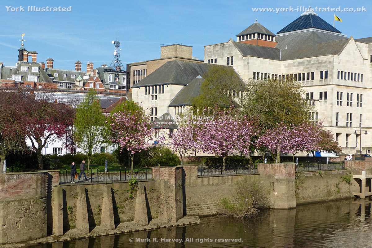
A modern office building (top-right) now occupies most of the available space on the southwest side of Wellington Row.
North Street Gardens (middleground) now occupies most of the space between the northeast side of Wellington Row and the River Ouse (foreground).
The low-rise white building (centre-left) lies on the southwest side of North Street, which has an end-on junction with Wellington Row at this location.
Image 2
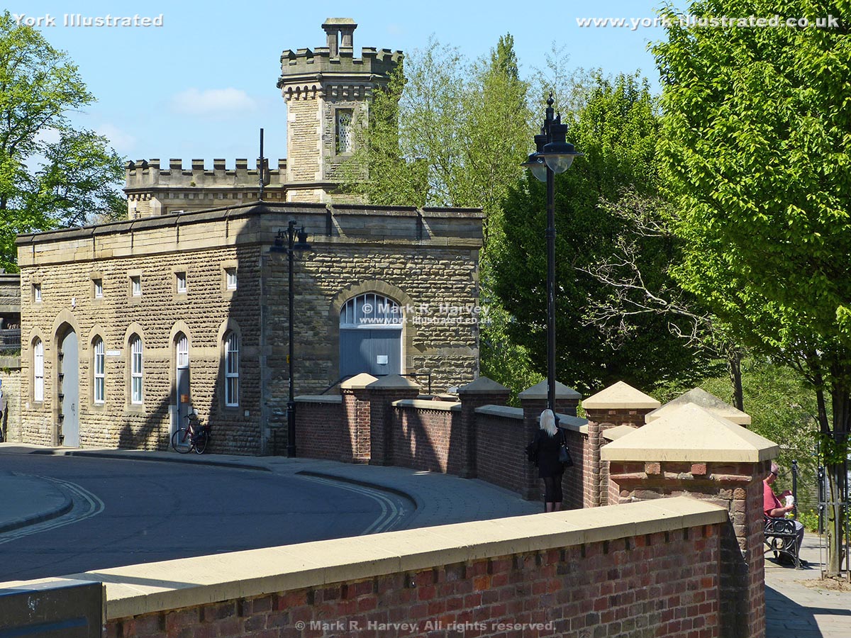
The Lendal Bridge Electricity Sub-Station building (centre-left) and the flood protection wall beside North Street Gardens (right) lie on the northeast side of Wellington Row.
As part of the £45 million response to the Boxing Day floods of 2015, the height of this flood protection wall was increased by 30cm (12") in 2019. (This photograph was taken in 2017, so it predates these alterations. However, the wall's appearance is relatively unchanged as the new brickwork is almost identical to the old.)
Image 3
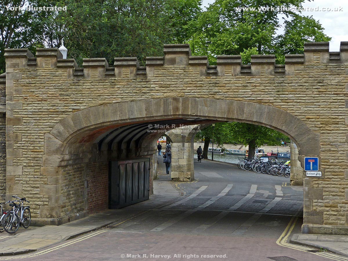
This flat arch structure forms part of Lendal Bridge. North Street Postern is partially visible beyond the arch. The West Esplanade and the River Ouse are partially visible beyond the postern. The main part of Wellington Row is in the extreme foreground and behind the photographer. There seems to be some uncertainty about exactly where Wellington Row ends and the West Esplanade begins. On many maps, this section of road is unlabelled. However, the author has seen it labelled or otherwise referenced as Wellington Row, North Street and the West Esplanade.
A brief history
During the Roman and Anglian periods, the strip of land now occupied by Wellington Row (and that now occupied by the West Esplanade and North Street Gardens) was significantly lower than it is today and it formed part of the foreshore of the then tidal River Ouse. There is considerable archaeological evidence of Roman activity slightly higher up the slope, which is not surprising as the Roman Road linking Eboracum (the Roman name for York) and Tadcaster crossed the river in this vicinity. However, by the Anglian period (following the decline of the Roman Empire), soil samples suggest that the area was probably being used for agriculture or horticulture rather than for habitation or industry.
Early maps of the city do not depict a formal road through North Street Postern and, prior to the first half of the nineteenth century, the route through the postern was probably little more than a field path (providing access from the North Street, Tanner Row and Toft Green area within the City Wall to the Bishop's Fields and river bank just beyond the City Wall).
Maps and city records show that the name Wellington Row was being applied to the area by 1822 and the assignment of this name almost certainly commemorates the Duke of Wellington's victory at the Battle of Waterloo in June 1815. By this time, the character of the area would have been very different (both to earlier times and to the way the area looks and feels today). Maps dating from the 1820s to the 1930s depict a row of small back-to-back houses on the southwest side of Wellington Row, with what appears to be a thin strip of agricultural land (perhaps orchards) between Wellington Row and the river. We can learn something of the early occupants of this area courtesy of Edward Baines History & Gazeteer for 1823, which includes the following listings for Wellington Row:
- Carle's Yard
- Clark's Yard
- Cade Jas. cow keeper
- Davison Geo. miller
- Jackson Geo. grocer
- Le Brun Thomas, hair dresser & fishing tackle maker (also listed in a separate section as "Fishing and Fowling Tackle Makers")
- Waterworth Wm. shoemaker
The area just beyond the City Wall would also have had a very different character during the middle of the 19th century. For example, the 1853 Ordnance Survey map shows the site now partly occupied the Rowing Club building as being occupied by a manufactury labelled 'Ebor Works Edge Tools'. This company made sharp-edged woodworking tools that are still bought and sold by dealers and collectors today.
Moving forward to circa 1933, a black & white photograph in the YorkExplore collection shows a row of two-storey back-to-back brick-built houses on the southwest side of Wellington Row with the seven storey brick-built Rowntree's factory beyond them and part of the Lendal Bridge Electricity Sub-Station on the opposite (northeast) side of the street. The sub-station is still standing today, but the houses and factory have been replaced by the modern limestone-clad office building visible in Image 1 above.