 York Illustrated

The South Esplanade is a short, virtually traffic-free street on the north-eastern bank of the River Ouse between Tower Gardens and the King's Staith.
Image A1
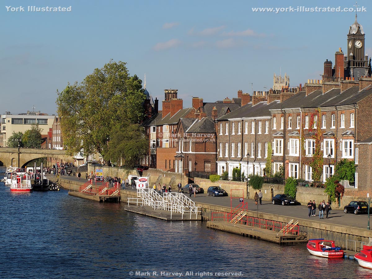
Image A2

Image A3

The quayside area now known as the South Esplanade probably began life during the sixteenth century as an extension of the King's Staith.
Early maps of York (including Drake's map of 1736 and the 1852 edition of the 6-inch Ordnance Survey map) refer to this part of the riverside as 'Friars Walls' or 'The Friars Walls' (rather than 'South Esplanade') and, according to the historian Francis Drake, a street or path of some sort has existed along this part of the riverside since at least 1659:
"Below the King's stayth, is a place of that kind of stone work called Friars walls; which is a long raised walk built, or rebuilt anno 1659, with a brick wall towards the water."
Source: Drake, Francis "Eboracum: or the History and Antiquities of the City of York”, printed by William Bowyer (London, 1736).
The name 'Friars Walls' is derived from - and refers to - the Grade II listed retaining wall on the landward (north-eastern) side of what is now the South Esplanade. The earliest sections of this wall date from the late 13th century (circa 1290) and it formed the riverside boundary of a Franciscan Friary. (The friary was established on the site in 1243 and the friars were given 40 marks by King Henry III as a contribution towards the cost of its construction. The friars were commonly known as 'Greyfriars' because they wore grey-coloured habits.)
The new riverside wall seems to have caused some controversy as neighbouring citizens complained that it had diverted the flow of the River Ouse, making navigation more difficult and causing damage to the river bank alongside Skeldergate. These complaints were eventually raised to the highest level and, in 1305, King Edward I ordered the city to use its murage tax to pay for a second wall to be constructed along the riverbank opposite the friary.
Despite the Franciscan Order espousing the morality of frugal living, the accommodation available in their York friary was good enough for royalty:
- King Edward II visited the friary in 1319-20 and occupied a room - or suite of rooms - referred to as the 'king's chamber'.
- King Edward III and his court stayed in the 'Friars Minors' for about six weeks in May-June of 1327. (Friars Minors is one of the names used in historical records to refer to York's Franciscan friary.)
- King Edward III visited again in 1335 and records show that he subsequently paid the friars one hundred shillings as compensation for damages.
The friary was surrendered to the Crown (as part of the dissolution of the monasteries) on 27th November 1538 and all of the buildings were gradually torn-down, leaving only the short section of river-facing wall alongside the South Esplanade.
One of the streets leading off the northern end of South Esplanade is still known as Friargate (i.e. Friars' Gata or 'the street of the friars').
By 1891 (when the Ordnance Survey's 1:500 scale 'Town Plan' was printed), the riverside area had formally acquired its current name of the 'South Esplanade', while the row of houses above and immediately beyond (i.e. to the northeast of) the wall had acquired its current name of 'Friars Terrace'.
The 'brick wall towards the water’ mentioned by Drake has long since been demolished (or buried) and the retaining wall on the river side of the 'South Esplanade' is now constructed from concrete-capped steel shuttering.
Practical Information
The South Esplanade forms part of a pleasant linear walk beside the River Ouse close to York city centre. The route links Skeldergate Bridge (near York Castle / Clifford's Tower) and Lendal Bridge (near York Railway Station and Museum Gardens) via Tower Gardens, South Esplanade, King's Staith, Ouse Bridge (near the city centre), North Street Gardens and Wellington Row. However, please note that this entire walking route lies within the functional flood plain of the River Ouse (see Images B1 & B2 below) and that it may be inaccessible when the river is in flood and for the duration of post-flood clean-up works. If you are planning a real-world visit, you may wish to bear in mind this Riverside Walk Safety Advice.
Image B1

Image B2
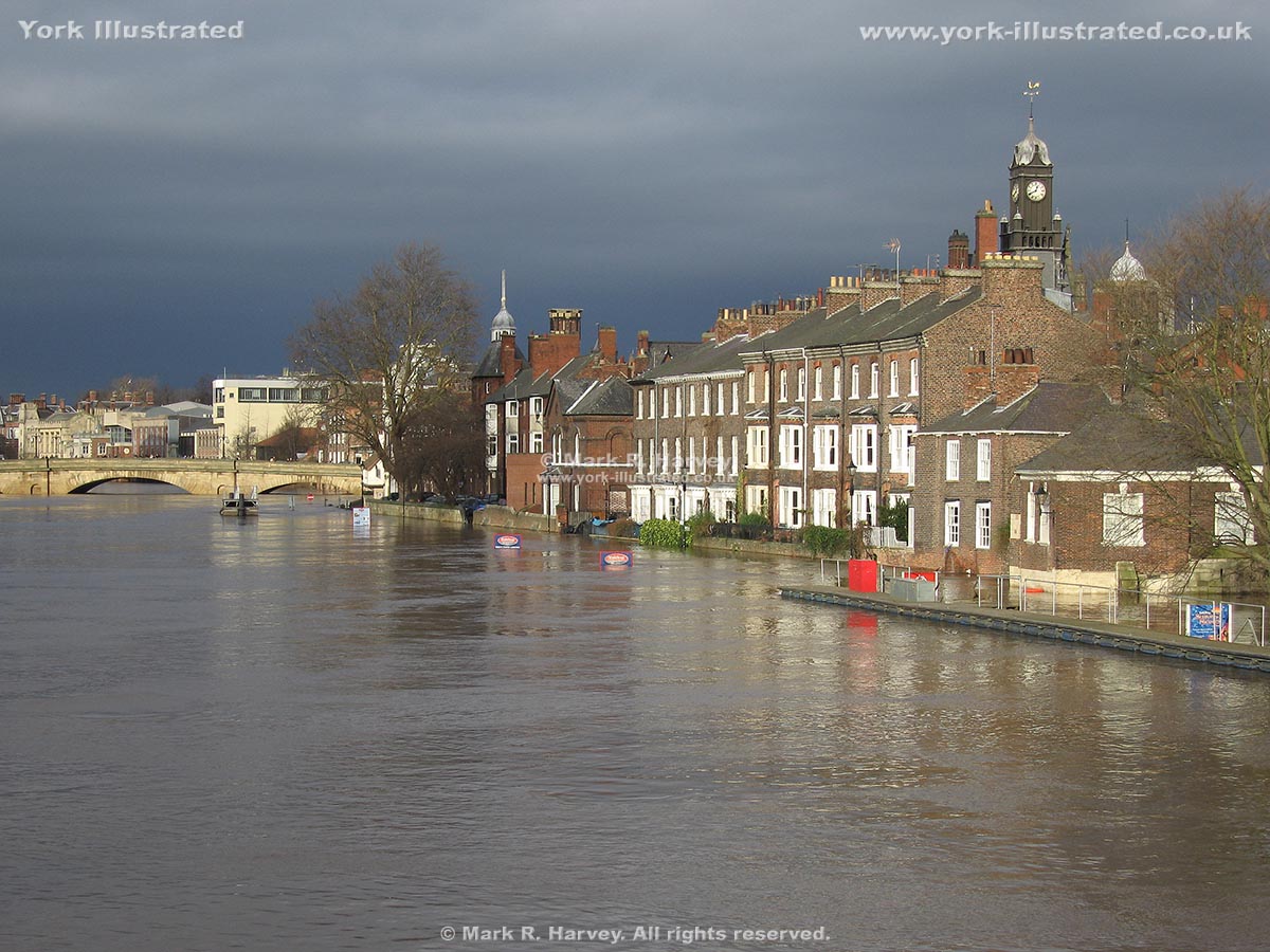
External Links
A wealth of additional information relating to the friary is available in section '99. THE GREY FRIARS OF YORK' on the following page of the British History Online website:
http://www.british-history.ac.uk/vch/yorks/vol3/pp283-296